基本信息
以下是所在類或對象的基本信息。
AMD:
require(["esri/layers/ElevationLayer"], (ElevationLayer) => { /* code goes here */ });
ESM:
import ElevationLayer from "@arcgis/core/layers/ElevationLayer";
類:
esri/layers/ElevationLayer
繼承: ElevationLayer > Layer > Accessor
自從:用於 JavaScript 4.0 的 ArcGIS API
用法說明
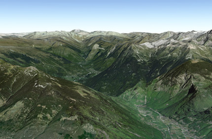
ElevationLayer 是用於渲染 SceneViews 中的高程的切片圖層。通過將 map's ground 屬性設置為 world-elevation ,可以將默認 world elevation layer 添加到Map中。

高程圖層在 map's ground 的 layers 屬性中設置。它們不應添加到Map的 operational layers 中。
let elevLyr = new ElevationLayer({
  // Custom elevation service
  url: "https://sampleserver6.arcgisonline.com/arcgis/rest/services/Elevation/MtBaldy_Elevation/ImageServer"
});
// Add elevation layer to the map's ground.
map.ground.layers.add(elevLyr);
如果從不同的域請求服務,則需要 CORS enabled server 或 a proxy。
相關用法
- JavaScript ArcGIS ElevationLayer.fullExtent用法及代碼示例
- JavaScript ArcGIS ElevationLayer layerview-create-error事件用法及代碼示例
- JavaScript ArcGIS ElevationLayer.on用法及代碼示例
- JavaScript ArcGIS ElevationLayer layerview-create事件用法及代碼示例
- JavaScript ArcGIS ElevationLayer.portalItem用法及代碼示例
- JavaScript ArcGIS ElevationLayer.visible用法及代碼示例
- JavaScript ArcGIS ElevationLayer.when用法及代碼示例
- JavaScript ArcGIS ElevationLayer.queryElevation用法及代碼示例
- JavaScript ArcGIS ElevationLayer.url用法及代碼示例
- JavaScript ArcGIS ElevationProfile.profiles用法及代碼示例
- JavaScript ArcGIS ElevationProfile.visibleElements用法及代碼示例
- JavaScript ArcGIS ElevationSampler.on用法及代碼示例
- JavaScript ArcGIS ElevationProfile.when用法及代碼示例
- JavaScript ArcGIS ElevationProfile.container用法及代碼示例
- JavaScript ArcGIS ElevationProfile.classes用法及代碼示例
- JavaScript ArcGIS ElevationProfile用法及代碼示例
- JavaScript ArcGIS ElevationProfile.on用法及代碼示例
- JavaScript ArcGIS ElevationSampler changed事件用法及代碼示例
- JavaScript ArcGIS ElevationSampler用法及代碼示例
- JavaScript ArcGIS ElevationProfile.visible用法及代碼示例
- JavaScript ArcGIS ElementExpressionInfo.expression用法及代碼示例
- JavaScript ArcGIS Element.visibilityExpression用法及代碼示例
- JavaScript ArcGIS ElementExpressionInfo用法及代碼示例
- JavaScript ArcGIS Expand.when用法及代碼示例
- JavaScript ArcGIS ExtrudeSymbol3DLayer.castShadows用法及代碼示例
注:本文由純淨天空篩選整理自arcgis.com大神的英文原創作品 ElevationLayer。非經特殊聲明,原始代碼版權歸原作者所有,本譯文未經允許或授權,請勿轉載或複製。
